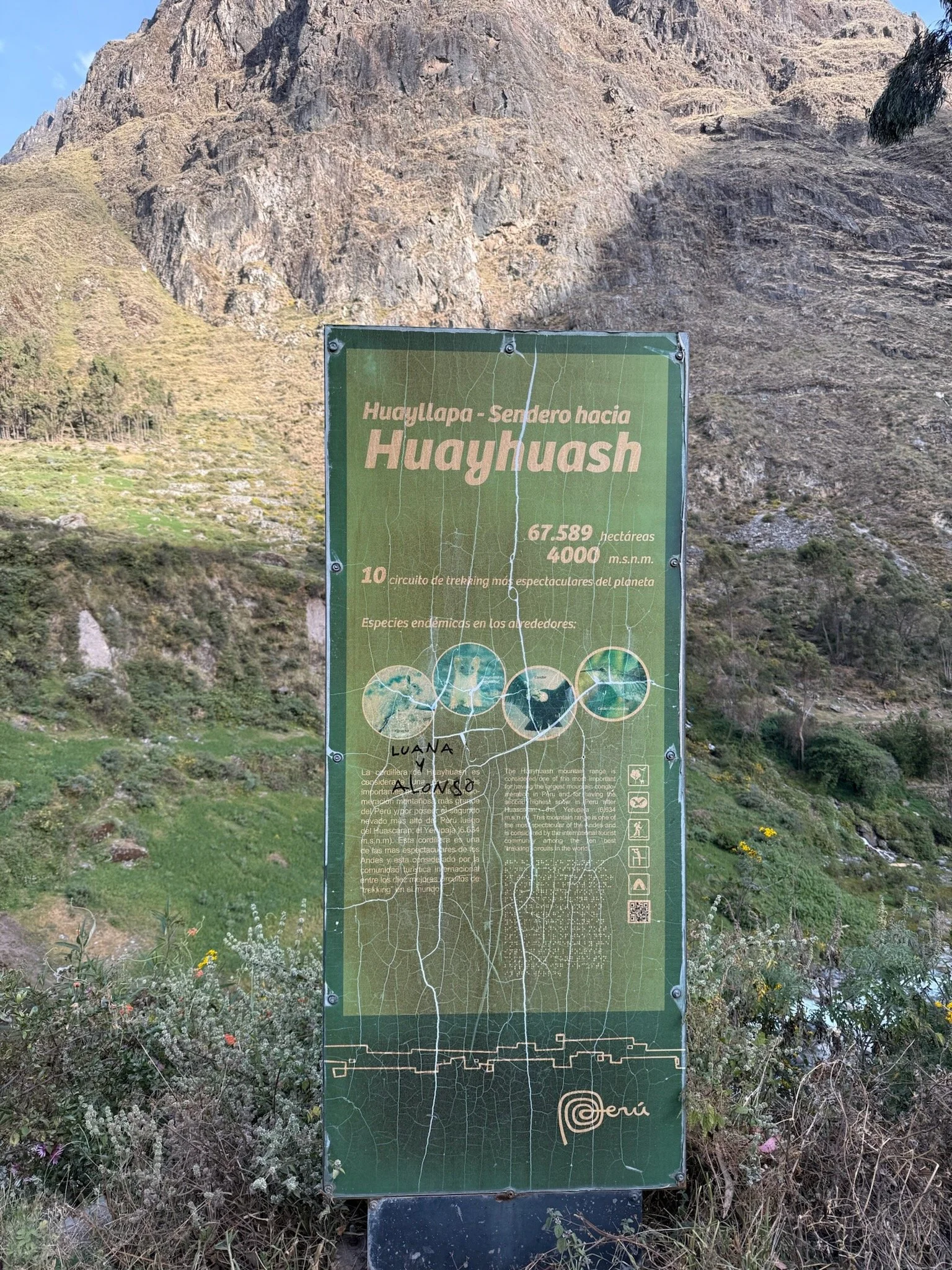
Cordillera Huayhuash Fastpack
Back in late 2019 I stumbled across a video on my feed on Vimeo called “Huayhuash”. It appeared interesting and I put it on and took a watch. I was enamored with the mountains, dialogue, and general feeling the video and locale invoked. “Never heard of the Huayhuash” I thought. A brief lookup showed it to be in Peru in the remote Northern Andes. The story and it’s location stuck with me ever since then occasionally poking it’s head up and seeking some airtime.
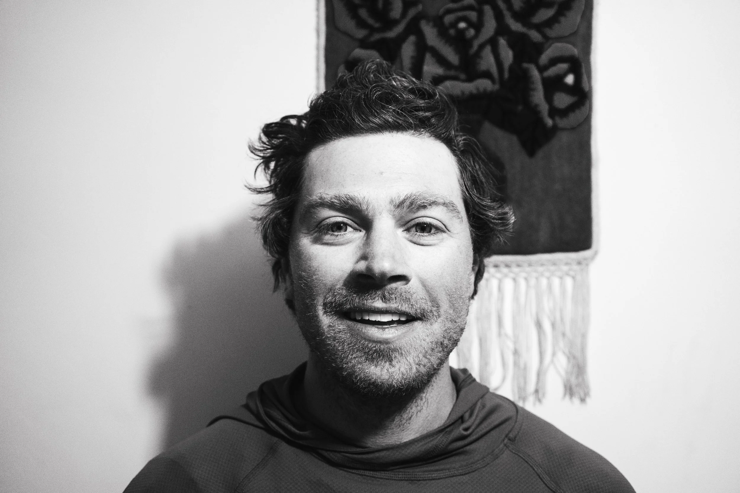
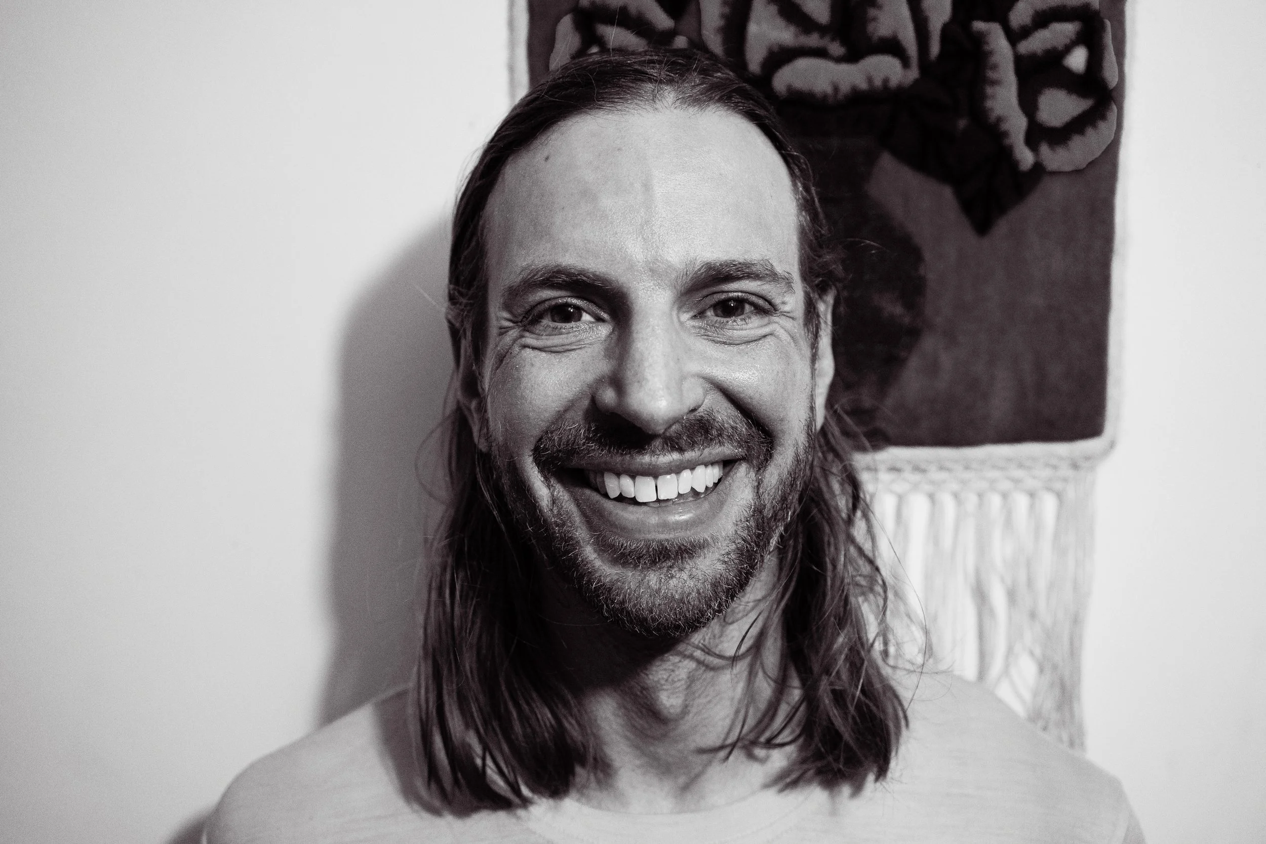
Last December while on the uphill track with Garrett it just sort of spilled out of me “Hey, want to go on an adventure to the Huayhuash?” We discussed it further afterwards while warming up at the Bromley market over a hot ham and egg slathered muffin sandwich and piping coffee from the thermos. Suddenly and abruptly, plans were hatched and it felt like I had a verbal confirmation from Garrett that this summer he would join me on an epic to Peru to move among the giants of the Huayhuash.
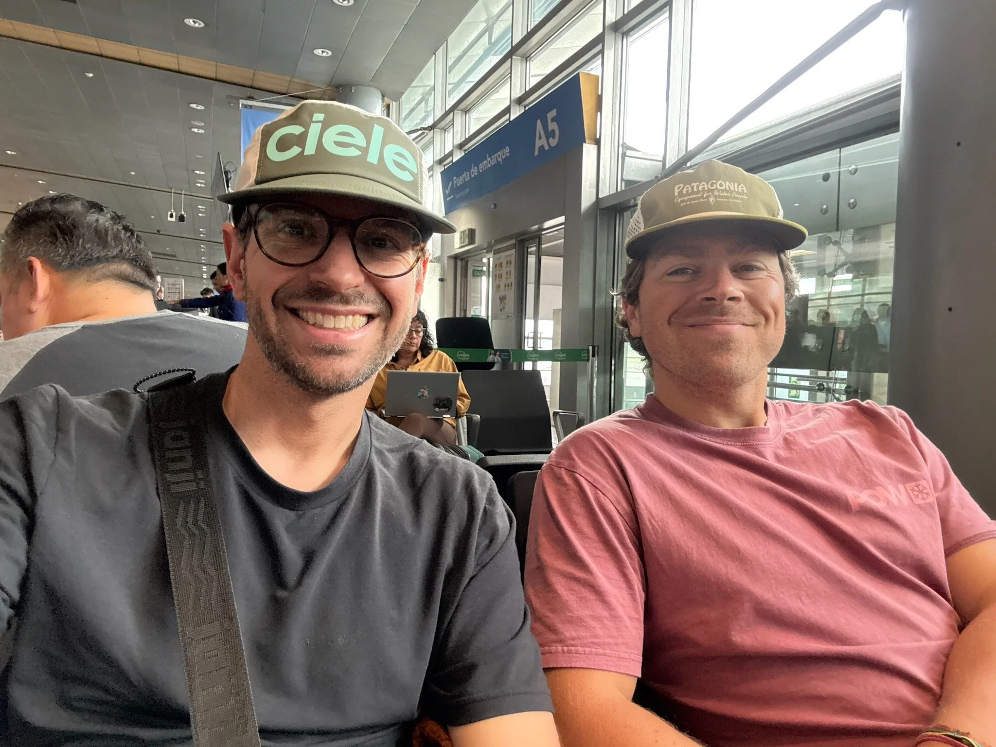
“Where the hell is this guy?” Garrett said. We sat in the front of the Toyota Hilux waiting for our fixer to deliver a paper ticket for us to leave the airport and get on the road. Minutes turned into hours and we finally were on our journey into Lima proper for a night before departing to Huaraz, the northern city we’d call home for the next two weeks. The drive from Lima was arduous and at times a completely drag with the surrounding views of shanty, desolate, and often abandoned homes and regions. It was obvious that Peru wasn’t unique in anyway when thinking about big mountain countries and their economies. Smog, dust clouds, and humidity filled the life-starved gap between Lima and the northern towns. Once turned off the main highway, we began an incredible climb to 14,000ft through winding valleys of granite and agricultural ground beds. We arrived to Huaraz Sunday afternoon with plenty of daylight to spare - what a joy to make it. We thought this would be a small mountain town but instead we found it to be a 100,000 person metropolis at the base of 20,000ft peaks such as Ranrapalca, Carhuascancha, and Huamashraju. The peaks cowed right over the city in the distance, far enough to be easily closed in by fog and cloud but close enough to reign a watchful eye on the Quechua people of the foothills.
Over the course of the next few days of acclimatization in town we quickly found ourselves enjoying the vibe of the Huaraz people. Food was delicious, hostel coming and goers were helpful, and it was easy to bounce around to find what we need. On Monday we headed up on a run to the the local trail past the cross point behind the eastern neighborhoods. It became suddenly apparent we were at 10,000ft and breathing was difficult. Stoke was high and we pushed through the run in the heat of the mid morning. With a scrambly descent that backed into someones backyard to find the paved road into town we finished our first run. I had a bit of slight panic with the dry heat and altitude feeling that was tougher than I expected, but realistically what did we actually expect? The next day we hit a hike starting at Pitec to head up to Laguna Cherup. This was what we needed - slow, methodically movement with some good vertical climbing right at 13,000ft. We took a slightly less used turn on the approach for the summit of the trail at the base of Cherup which led to some exposed scrambling with a few British kids. Saw too many folks up top to be comfortable and some Americans. I knew this was a touristy type of trail and it was to be expected - I don’t think Huayhuash will be like this at all. On the way back from the hike we brought down a local university student and her friend who had walked up to the trailhead from Huaraz. I was blown away that they casually took this approach to the actual Laguna Cherup - it captured the essence and attitude of the local Peruivan people.
Wednesday morning we woke up and it was go time. The plan was to drive ~5 hours to Llamac, the psuedo start of the Huayhuash for some - it would be our launching point for a true start to finish run of the circuit. I didn’t know much and Llamac and information was scat to come by before the trip during research and planning. The most we gathered ahead of time was that it was a small village with supposed hostels and a restaurant? Either way we punched the Hilux south and drove out. After cresting 14,000ft, the road quickly wound down into a dirt road roughly 15-20% grade for miles with never ending switchbacks to the picturesque town of Chiquián. We blazed through hopped on coffee, road snacks, and enthusiasm for the Huayhuash. We rolled into Llamac, paid our fee and slowly paced the town of just a few streets. Things looked closed, quiet, and sometimes abandoned. No signs to speak of and nothing obvious but just a few Quechua people skipping down the streets. We finally landed on what looked like a small bodega with an elderly man standing near the doorway. He directed us to a woman who gave us a room upstairs and a spot of grass to put the truck down the street in sometimes backyard. It worked out well and we found ourselves with a hot meal tonight, packing up our packs while counting meals and things we maybe needed or didn’t need. It started to feel real and scary stuffing each little thing into my meager 25L running vest. Tomorrow morning, we would set out for 4 days/3 nights on our own to find just what the Huayhuash is and indulge in the child-like fever of making decisions on the fly and suffering by the seat of our pants. It was finally time time to step into what was for years a yearning, a fever-dream to explore and get rowdy out in the mountains where no one knew you name and no one back home quite understood where you were actually going
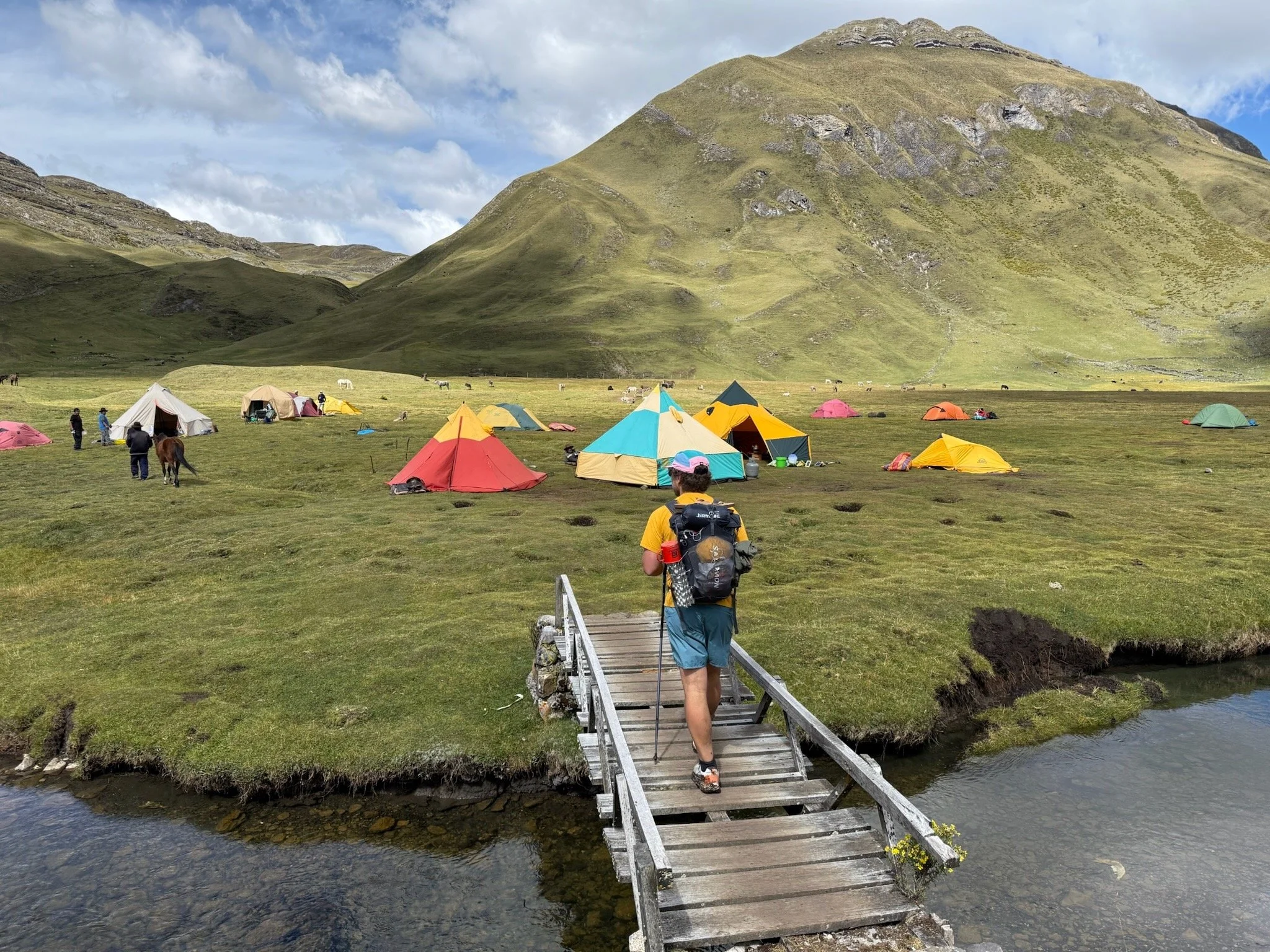
My phone vibrated and rattled the small table it rested on. I rose and blinked a few times and thought to myself “It’s now or never and we have to go”. We got things together and breakfast was served in our room - two small bread rolls with egg inside. We devour them, prepared final packing and dropped out the bottom door. The smell of the air was cool and crisp this morning with a lingering alpenglow setting off the western peaks watching over us. We started hiking up the road and out of town. No running here, we needed a warmup. The minutes turns to hours and we began weaving our way up the road through Pocpa, mining villages, and the rural person or two eking a living out of the high countryside. Landscape began to turn to drastic, large granite peaks towering above us and then behind us. Eventually, 9 miles later we made it to the assumed start for most trekkers and tourist being shuffled in by touristco minivan kicking up dust all around the place, Cuartelwain. Not much more than the end of the road, some grass, and a brief and confusing trail start is the kickoff point where groups were assembling with burros being lashed with all the accoutrements trekkers required. We noticed in the guidebook that I acquired some years ago to watch out for nefarious payment collectors who asked us to pay the same tariff amount we paid in Pocpa, good for the entire distance to Cuartelwain. We politely showed him our paid ticket, and continued onwards.
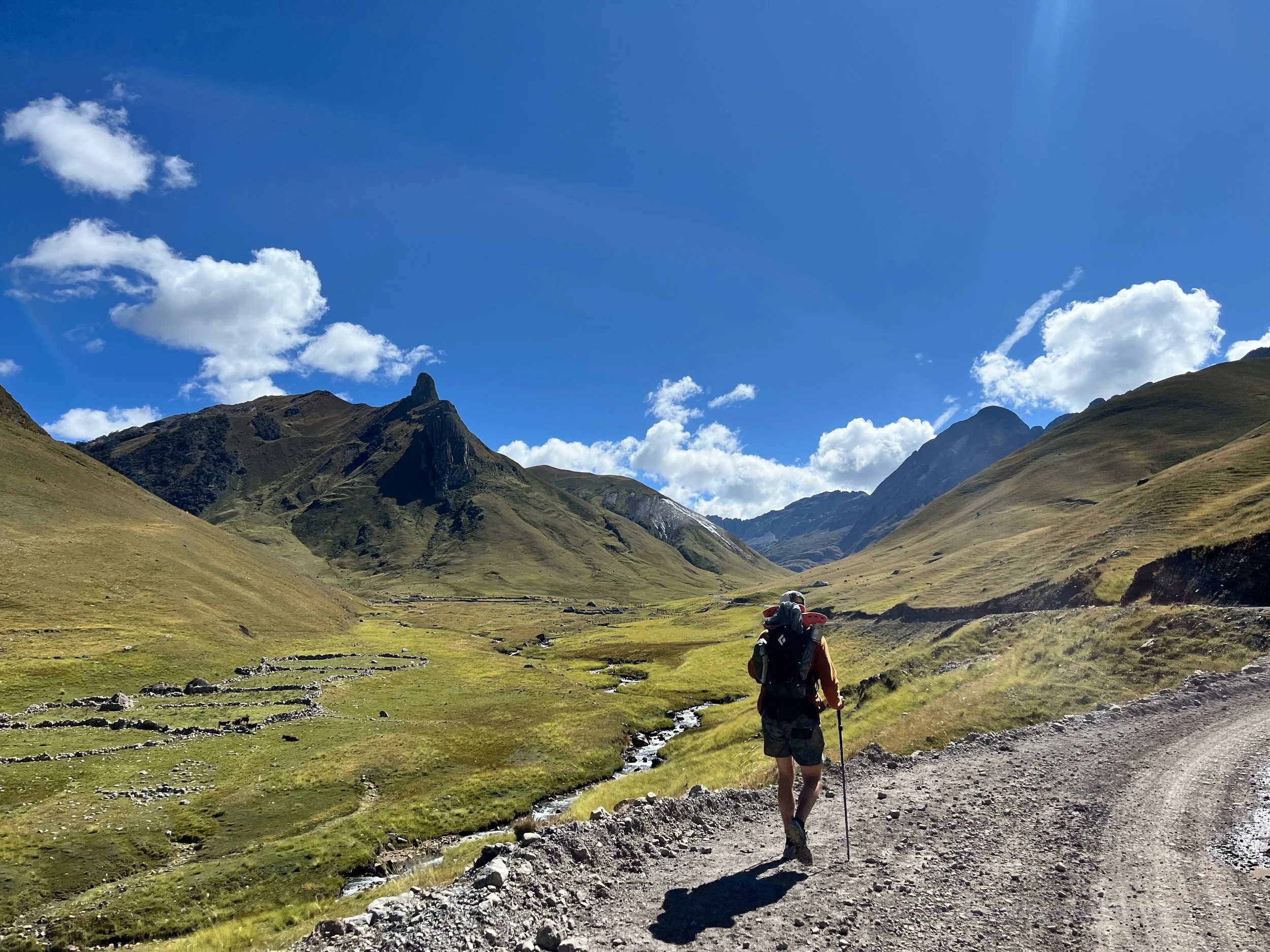
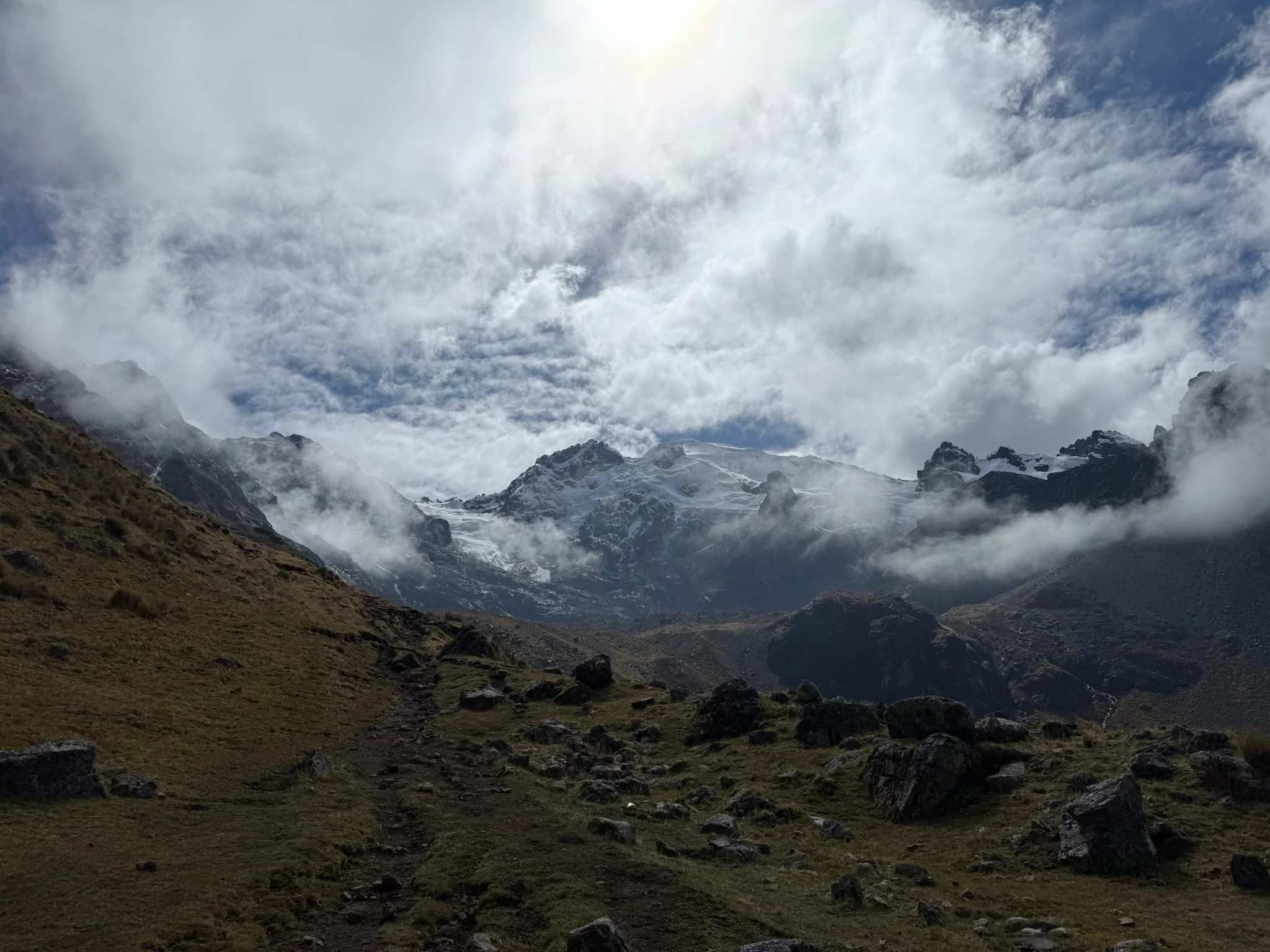
This began the climbing as we rallied and hammered up Quqanan Punta right around 4700m. The climb was breath taking literally and figuratively. One person described the first climb as “unrelenting” and it was exactly that. Garrett kept good pace and we passed plenty of parties, but with the steep climbs we quickly encountered just how difficult it was to move light and swiftly through the trail at this altitude. All systems felt good and we pushed onwards up and over the pass. Photos, snacks, and a few sips of water. Head felt good and we cranked down the backside to an endless view of green rolling mountains and a perfectly scribed trail off the left winding its way east and south. I pushed on quickly while Garrett relented to an easier pace. Already, I sensed his steadiness and willingness to move slowly and methodically as to not twist something and get hurt too early on in the endeavor. I, however did not possess the same restraint as I nearly was running down the back of the pass with the easy effort grade and months of built up power in my legs. Within a few hours we made it to Campo Mituococha, the first major camp on the circuit. Traditionally, if trekking with a guide and/or group your day would of started at Cuartelwain and ended here. This was barely lunch for us at this point and we continued onwards. The views began to become dramatic as rising white peaks, some of the most famous in this range became apparent in the skyline and the gradeour of the Huayhuash started to become clear to us. “Holy crap, this is incredible” I said to Garrett as we sat in camp and filtered water from the nearby riverbank flanked with burros, cows, and horses. “I know man, what a day.” Spirits continued to remain high. We took down lunch (Clif Bar and some chews) and popped back onto the trail, an obvious rise and climb right out of the campground. We veered off track to get into the camp initially to filter water so it was a direct slog through some burro poop soaked wetland lowgrasses to get back to the trail, totally worth the maybe 5-10 minutes we saved by tracking back to where we originally came off trail into the campground.
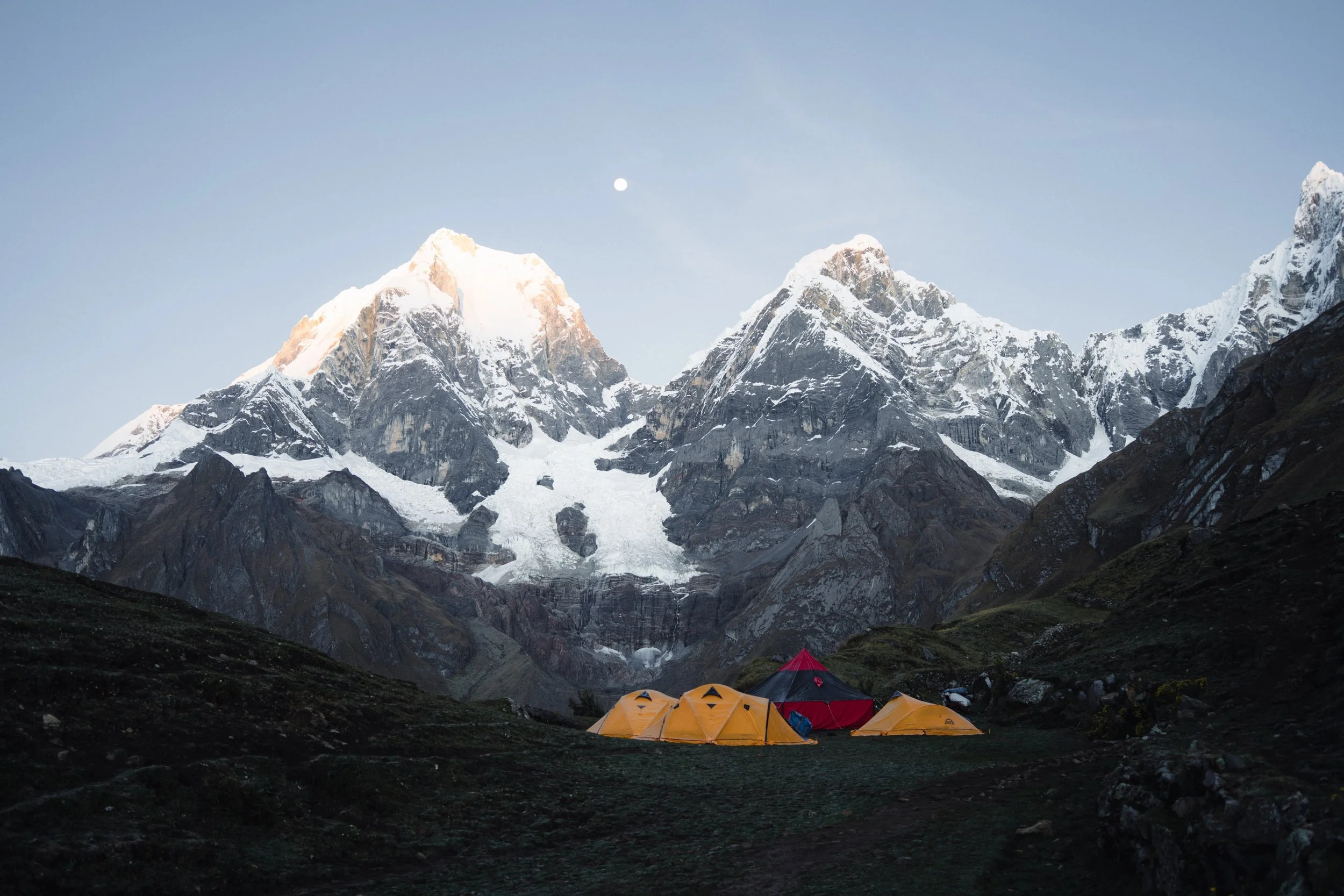
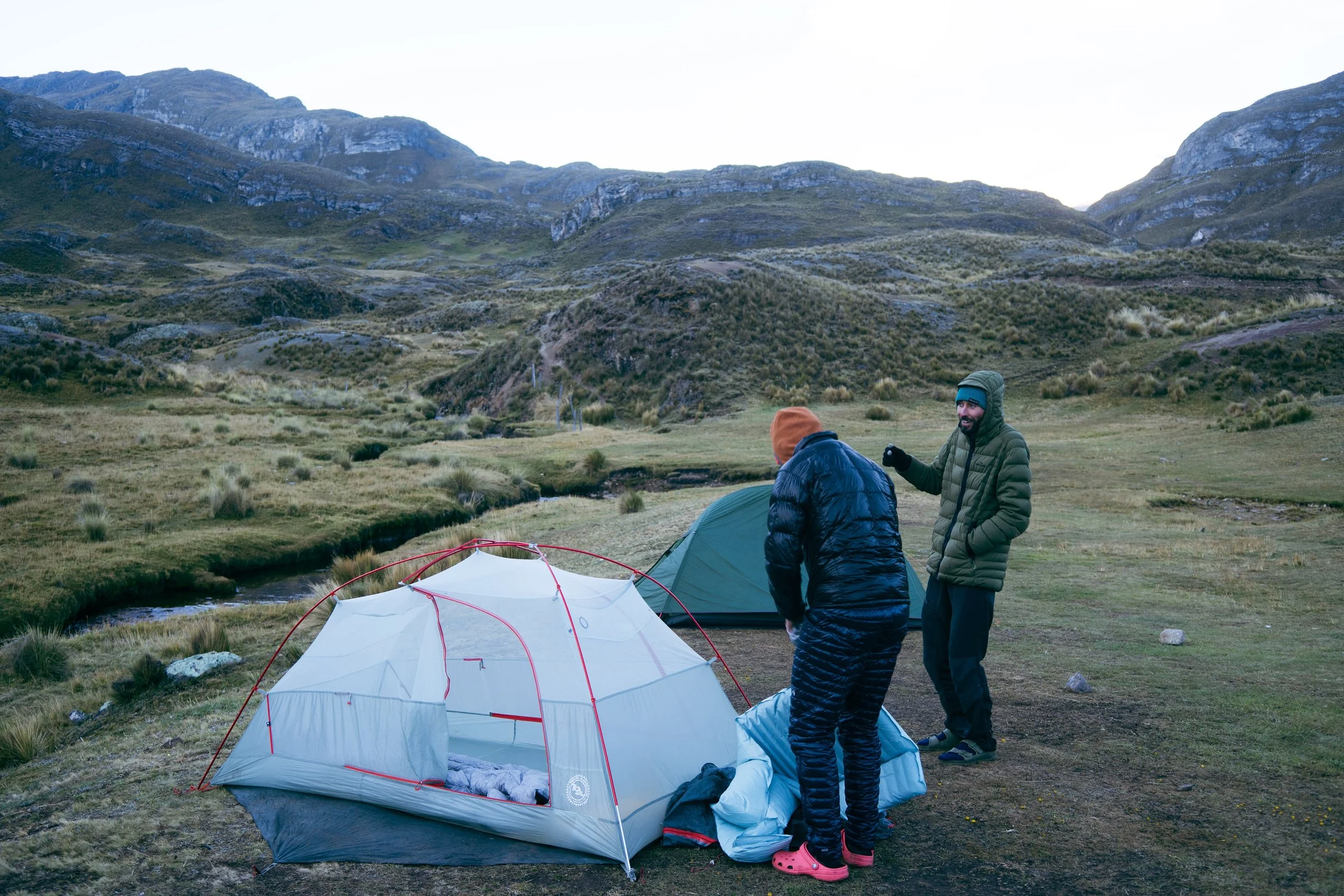
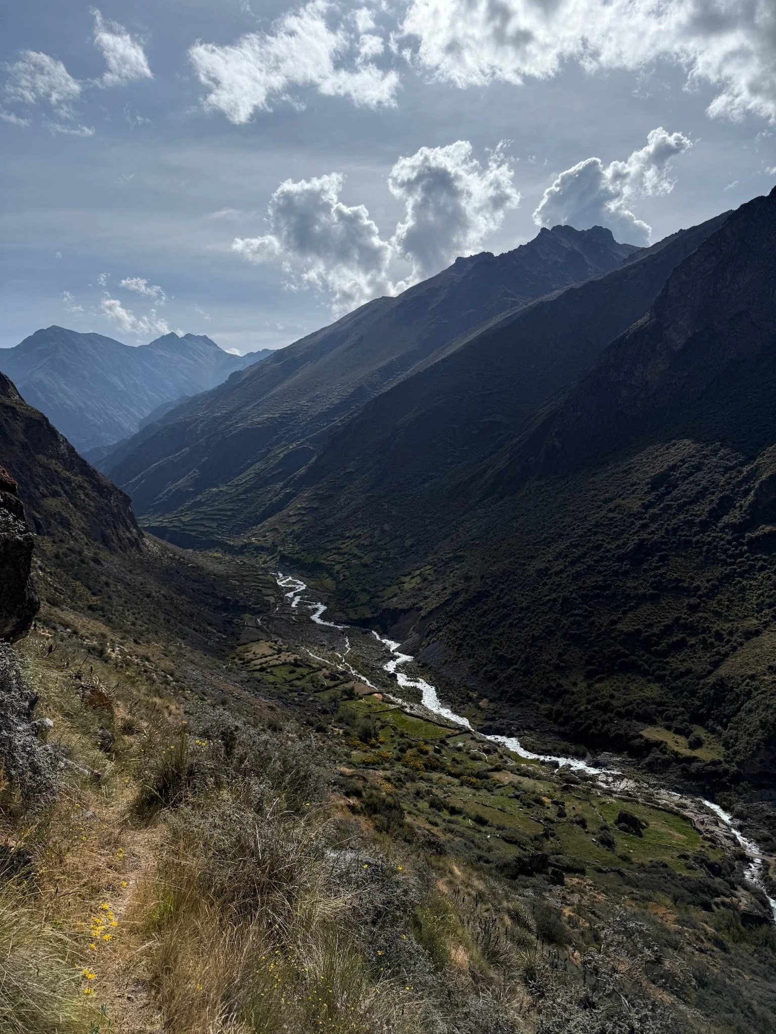
From here, we pushed the climb and it felt like we were going to be on this climb for hours. Miles turned into another few hours and we found ourselves finally descending the backside of the climb (Punta Carhuac 4650m) to a tapered drop with stone walls lining up the mountainside from what looked like a grassy knoll once occupied. Up until this point in the trip, and in the Huayhuash it was incredible to see the craftsmanship put into the stone walls and the seemingly perfect alignment of stones that have sat for hundreds of years untouched and in solid form. Something truly mind boggling as it hurt trying to grok the effort this would of taken when it was performed by the Quechua’s. After the a bit of some more moving we made it to a rocky knoll where the distant white peaks began to seem closer and closer. Did we suddenly rock up to the side of the high peaks? It sure felt like it - we rolled over the knoll and below could see Laguna Carchuaccocha and the Campo Carchuaccoha with three distinct areas with tents pitched. The view over the shoulder to the west was breathtaking. Front and center we could see in near entirety the core of the Cordillera Huayhuash - Ninashanca, Jirishanca, Yerupajá, Siulá. Sitting just above 20,000ft or 6,100m in perfect clear skies. It was truly one of the most breathtaking views I’ve had the honor to be in front of. The lake sat just below the heel of Jirishanc and couldn’t have been more picturesque. Garrett and I, relived after a 22 mile day found a spot to pitch the tent near another group of tents and got to work on photos, reveling, and setting up camp for the night. Our tent system worked well and it was off to boiling water for dinner - Beef Stroganoff with a side of hot water in a cup. Delicious. We ate dinner, looked at the setting sky above the peaks, and barely spoke many words. We were worked from the long day and emotion of starting the fastpack. Temperature dropped and we found ourselves fully dressed in pants, down jackets, and hats. By 7pm, it was time to shuffle into the quilt and head to sleep at 4,150m (13,500ft).
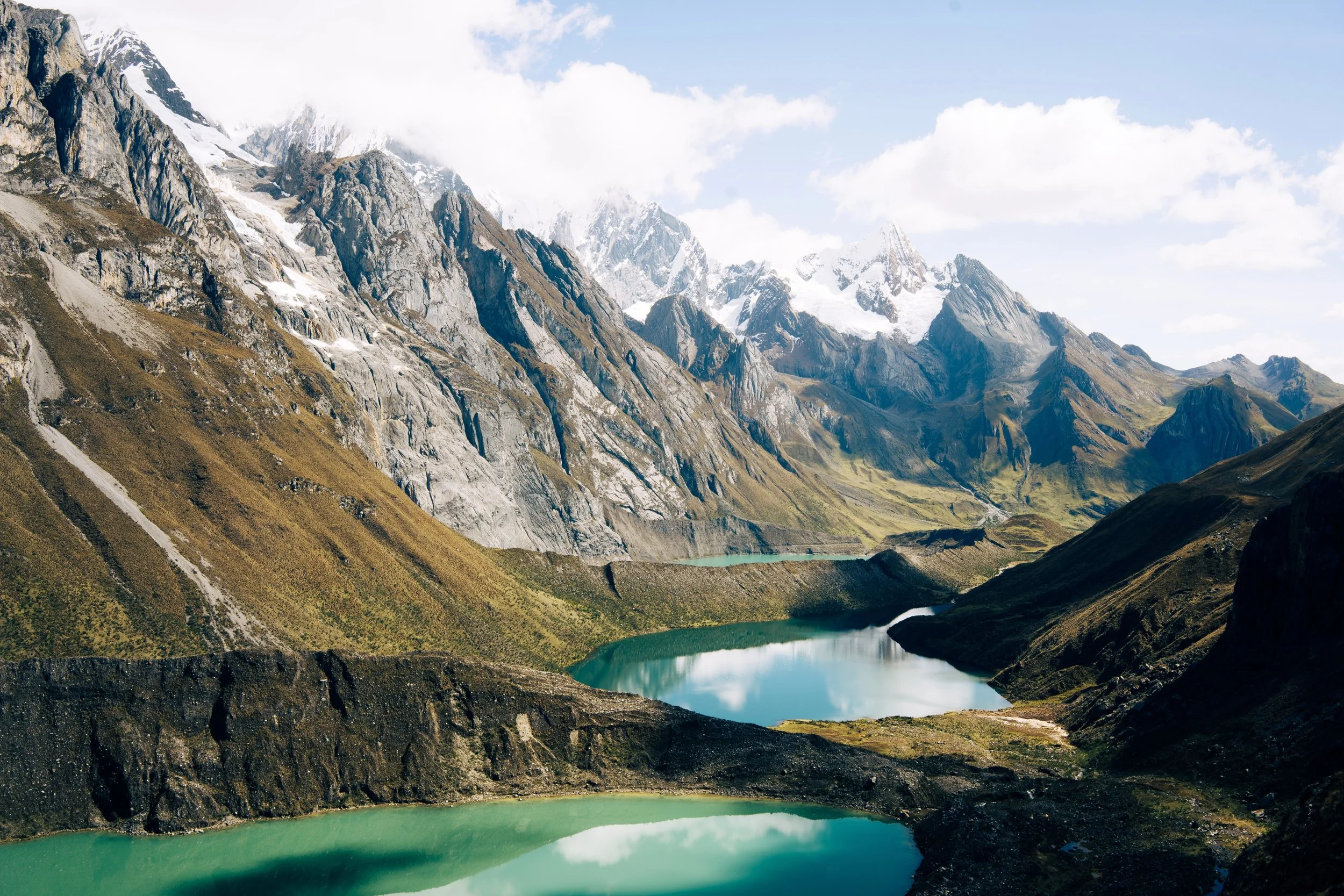
I awoke to the sound of mules and shuffling feet. Porters, cooks, and trekkers had awoken early and were nearly out of camp. 6:32am and I rolled slowly and quietly out of the tent. “You awake?” I whispered to Garrett, wondering if he had the as rough of a sleep as I did. At 14,231ft I couldn’t of expected to sleep that badly, waking every other hour to just toss, turn, get comfortable fall back to sleep. Turns out this is fairly common, especially above ~10-12k. He rose and we started to break down camp and get brekkie underway. One probar each – banana nut bread with some instant pour over coffee. Coffee may have been the best part of the morning, with temperatures hovering around 25F it hit exactly how you’d expect it to. Took about an hour to pack - pads, sleeping bags, tent, supplies, etc. We applied a thick layer of zinc on the face and calves as the sun was out at this point and I could feel the warmth radiating already - it was going to be a great day. We were some of the last to roll out of camp considering we were the only ones breaking down our own tents and equipment. It was off to the races down the hill to track the south side of Laguna Carchuaccocha. Spectacular views gave way to an ablation valley and the steep and obvious climb up to the moraine just above one of the classic mirador’s of Huayhuash - the Tres Lagunas flanked by the jagged, icy peaks of the core of the range. Atop we hung with some Kiwi’s that were out for a boys trip on the circuit. We nearly passed every party that departed camp before us with a zest and motivation to keep moving. “God damn, this morning’s climb was beautiful” I said to Garrett. We grabbed a few photos on the moraine, awed the inspiring peaks and continued down to drop into the marshy valley that slowly sailed and weaved through long, grassy knolls along steep green mountain sides. The walls couldn’t have been more impressive along the mountain slopes, what was the driving force behind these walls? Surely most of them date back to the Incan period - immaculate and solid walls in perfect form like a wonderful unison grasses swaying and standing in the wind.
We drop into Huayhuash camp finally, a big green pad of a field after ~3,000ft of descending the hoppy path off the mornings Punta. We pay the cobrador who seems perplexed when we tell her we’re going to continue onwards to Laguna Viconga for the evening. It’s about 12:30pm and we eat and drink what we have. It’s hot at this point and the sun has been beating down on the back of our necks, skin red and completely dried out. It was at this point I think Garret and I began to felt the first tinge of fatigue setting in from the exhaustive effort at altitude. We took refuge to filter water and eat in the bathrooms where the only shade was the be found in miles of any direction. Once filled, eaten, and packed we took off. The cobrador nodded to us good luck and waved apprehensively. If anything they may have been upset we weren’t with a guide or porter group to utilize services which I understood, but we had a different aesthetic in mind for this traverse.
We made our way up a pre-Incan path to a long-steady sun soaked climb that took it’s time gaining the hillside. Eventually we entered through a small wooden gate to a stone corral once used for herding at some point which served as our second high-point of the day. Garrett and I’s conversation was deep at this point - ruminating on all things being a worthy adult and man in this world as well as the fruits of our life we’d left behind to make this thing happen. It was so assuring and comforting to have Garrett with me out there working towards the same shared goal - something I relished in the moment and carry with me to this day. Someone who will cross into the unknown with a mind operating like a parachute - successful when open.
We criss-cross paths and start descending aggressively, skidding the rubble loaded mountain side where the sun hides behind and it becomes darkened. The wind picks up and within a matter of minutes the temperature dropped and gust got up to 20-30mphs. I couldn't even hear Garrett unless we were side-by-side. It was nearly 3:30pm and we were feeling the grind of the day. I stop to toss on my down jacket and Garrett does the same. We continue traversing down with Lagun Viconga becoming everclear in the distance past us. Suddenly with haste runs a herd of Alpacas to our left along the scree field up ahead. A few minutes later, more and more come into view and we paused. We looked around to see nearly 100+ Alpacas ranging along the hillside and to the left near some chozas and corrals. My assumption was that this was a wild herd that roamed this area, it was something special to see this many out there, free. In the chaos of this all, high winds, alpacas flanking us, and a descending trail, something sinister happened and I wouldn’t find out until about an hour later. We finally make our way down and then up a short uphill to the lakes moraine crest with a junction down - one way to the Agua Termales at camp or the other to Punta Coyoc. Our goal was the Termales and camp for the evening. We quickly hiked down and passed the deserted Voconga camp denoted on the map - somewhat strange to see it so empty as I thought this was a major setup point. We rolled into the Agua Termales campo and greeted the cobrador with his family and a few rubble shacks. The pools were steaming in the cold wind and it was like a hallucination in a dry desert to see these hot bodies of water welcoming us. There was one other party here still - a party of about 8 from Israel whom we weren’t the fondest of. We’ve seen them at our first hostel in Huaraz and they couldn’t have been more rude with their noise, trash, and hospitality. After chatting to one, they were luckily bowing out early and hitching rides the following morning from an apparent dirt mining road with car access to the campo. Regardless - we quickly undressed and hopped into the pools with the cool setting sun off to the west.
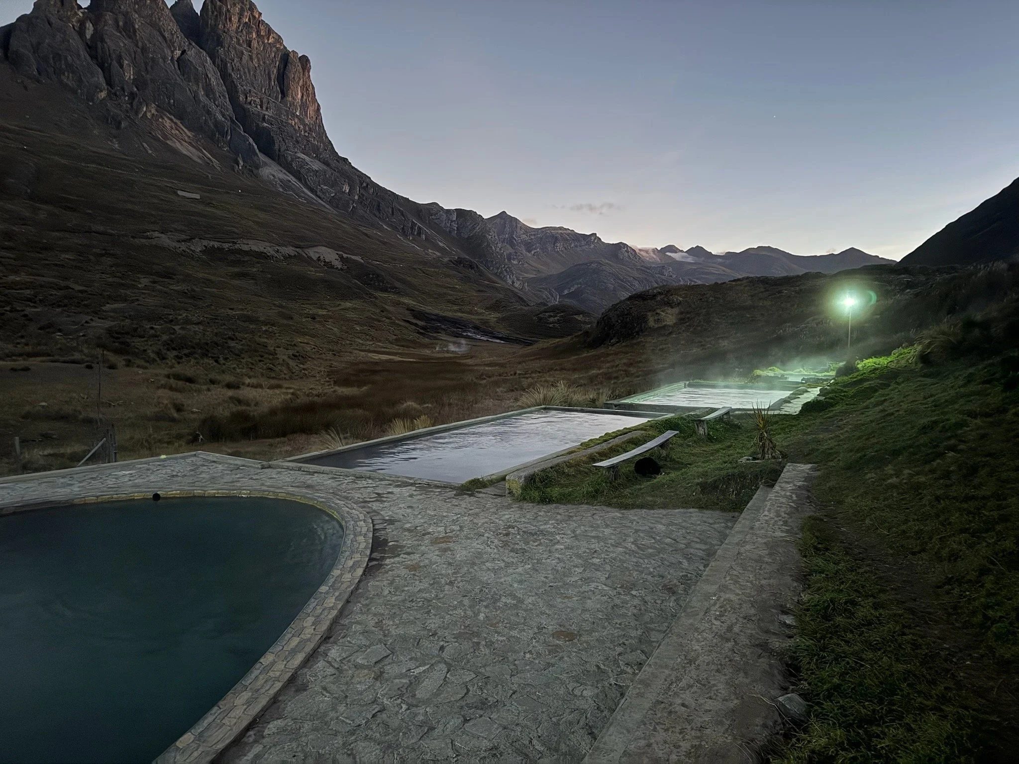
I’ve spent some time in some hot springs and hot tubs and I can say without a doubt these were the more rewarding I’ve been to. We bathed, chatted, and sat there in the 110F water while the wind whipped and the light faded off the mountainsides. Dinner and tent setup could wait at this point - our goal was to spend as much time as possible in these before we coiled up like a dead snake.
I get out of the hot tub and get dressed - the sun has dropped a bit and we’re in the shade now along with a cool eastern breeze. It’s actually really cold and I nearly have my bag packed when I don’t see my sandals or sleeping pad. Strange - I remember having it on top of my Y-strap on the top of the pack the entire trip thus far. I look around frantically and start to have this sinking feeling - their both gone. Did someone take them? The other folks around are the Quechas sitting in their shack, the older woman tracking an Alpaca behind the springs, and a gentle couple roaming around looking cold. I ask Garrett to help me find them and we look for a few minutes to no avail - we really didn’t move elsewhere before we dropped our things, stripped and lounged into the springs. After walking barefoot out to the flattened grass pasture behind the rumble shack I start to think about how earlier in the day when we were descending the north side of Laguna Viconga we stopped to throw long sleeves and jackets on. I remember putting the pad and sandals back onto the pack in the Y-strap, but maybe not strapping them down tightly. It was horrifically windy and I was moving with a zest. It fell out of my pack and I didn’t even realize it. Horrified and a bit scared with this realization it occurred to me I had nothing to sleep on for tonight, and the following night and possibly more if we get stuck out here or something went wrong. No where to get a pad.
After a brief panic - I resign myself to get the tent set up before it became too dark and cold. We set up about 25 feet from that couple who was roaming around earlier looking a bit chilly. They ended up being a wonderful couple from Croatia who were trekking the Huayhuash circuit over a few years and enjoying every minute of it. I explained my plight and he generously offered me his z-pad for the night as he had been using it as an insulator under his sleeping pad. It was gracious of him and I immediately felt comforted that I may retrieve a decent nights sleep at this point bringing me back to a place of security and safety. It was another example of the incredible kindness of strangers and those you meet out in certain settings where the variables are countless, the rewards high, and a shared experience of a common toil. We sit in the rumble shack with the locals to enjoy Peruvian matadors cross-dressed waiving flags at angry bulls on a shotty tv hanging in the upper corner of the tienda. Believe it or not the older man began scrolling through Youtube channels on the tv using a Starlink. I wish you could have seen this shack with a kitchen, tienda, and living room all within 15 square feet or so. We head to sleep, cold, bellies full of beef stroganoff, and exhausted. It was night two of the Cordiella Huayhuash.
4am and I’m wide awake until 6am. It was a good two hours to close the eyes and daydream while not being able to sleep. Tossed and turned quite a but in the cold but was cozy in the Hyperlite quilt. I wait to make noise and wake Garrett up around 6:15am. Sun is out on the horizon and things are frosty outside. I got up to filter water and everything was completely frozen, including the completely out of this world porcelain toilets placed near the site and single tap jetting out of the ground. I walk around to get things moving a bit and find a local dog completely covered in a layer of frost - he certainly spent the night out here but looked prepared with his coat. It was really impressive to see a dog truly adapted to his environment - a far cry from Cheddy back home in the safety and security of his warm 68F bedroom sleeping on Emma and I’s bed.
We quickly retreat and take solace in the rumble shack with the Quechua locals and find the Croatian couple there. They mention you can buy a 3/sol egg sandwich and we jump on it; sounds quite a bit more tasty then our frozen probars. We down the sandwiches and get to the water, its finally trickling enough to fill a flask and filter. We snap through a few flask of water and get camp broken down in the cold. It takes nearly ~3 hours from waking up to begin cruising up the trail. Much slower than I wanted but with the freezing conditions and Garrett's seemingly slothy movements in the morning it made sense we’d “enjoy” this time and not rush the process of starting our day. Sun blast the locale and it immediately feels warm, shorts weren’t such a bad idea this morning.
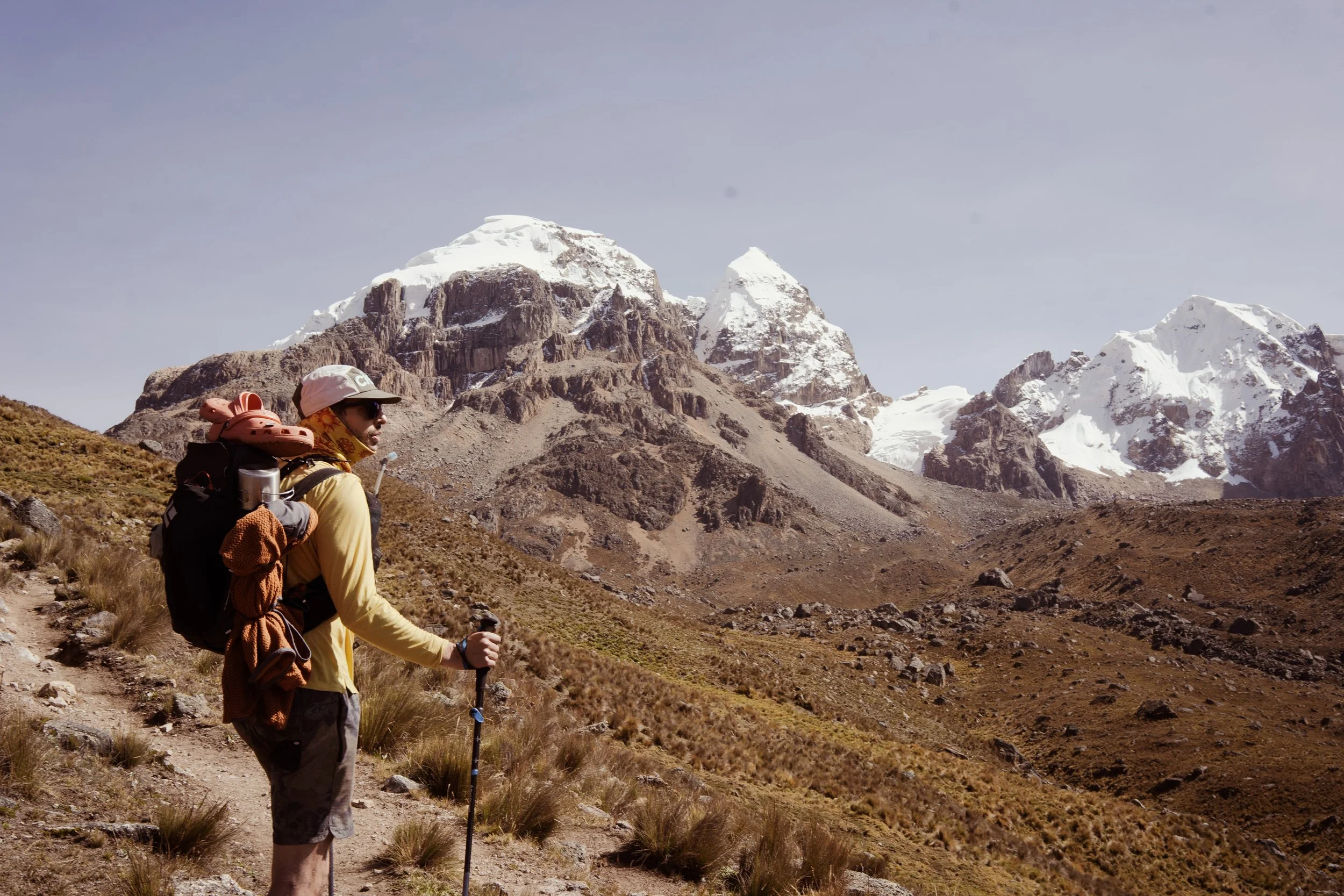
Garrett and I blast up the trail and it’s quiet out there. Once we pass the Croatian whos headed out before us, it was a steady climb up some winding trails to the north east and finally up to Paseo Cuyoc (16,650ft) as the high point of our route. I beat Garrett up there with a show of force and agility pounding up the final half mile above 16,000ft. Somewhat surprisingly the altitude was feeling more manageable and better, albeit still tough on the lungs and weighing on the legs. The sun was blasting at this point and it was warm and dry. The view up was spectacular as we made our way, with views of the Cuyoc (17,716ft) and Puscanturpa (18,543ft). We observed a party making its way down Cuyoc and possibly headed to Viconga but more likely Campo Elefantepama which was the next camp on our route west at this point. We took in the views, snapped a few photos, ate and drink bit and looked onwards where the trail seemed to file off the mountain and down and endless sloped horizon flanked with snow capped peaks to the south. We began out descent which was slightly scree filled initially and began to stabilize with larger boulders and rocks underfoot and an obvious trail. This brought us down into a long, luscious valley with some cows grazing to our right and Incan-era stonewalls lining the southern border of the valley. We continued down until the trail leveled out and it was a nothing more than a gradual walk down the horizon. We passed campo Elefanta Pampa and snapped along the ridge looking down and thinking about our route. We finally came to a section of the trail level with the water source which had been flowing from high valley streams and runoff now middling through the valley. We eat a snack, filter water, and take in the midday sun. It’s hot enough now that I reapplied zinc to my face and pulled the hood up and over my neck so as to protect it although it’s been days with this sun and elevation and the damage has probably been done at this point.
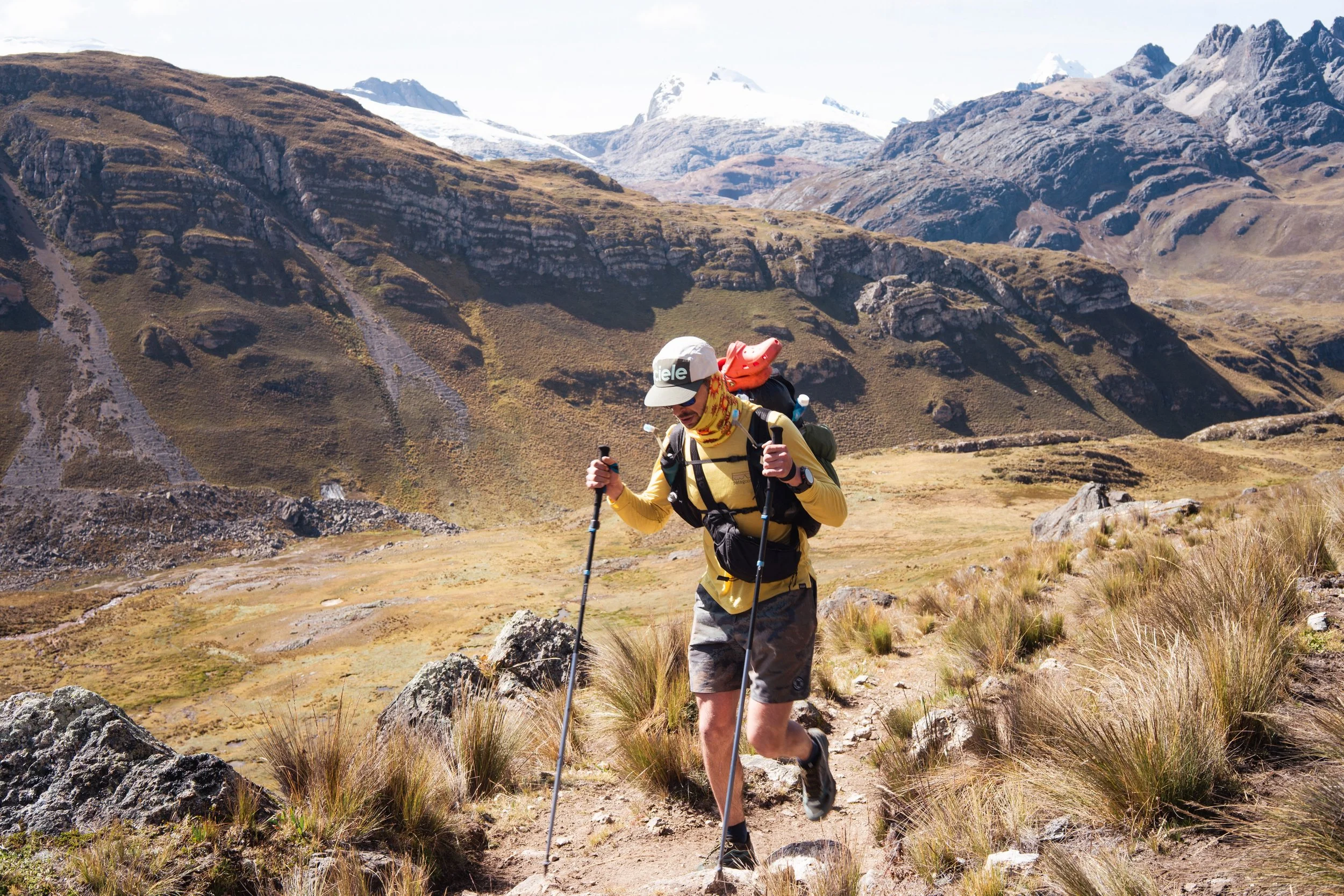
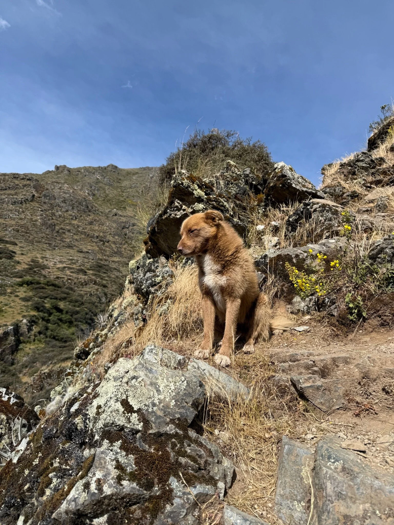
As we headed onwards, we eventually came to a boy shepherding some sheep up the valley floor. It feels really remote at this point and unclear where any civilization lies from where he must of came from. It wouldn’t of been north or south up the walls of the valley, they must be 2-3k high and steep with scree and rock. Maybe it was down valley but the horizon was set at an angle and we couldn’t see what was up ahead. With him was a beautiful golden colored dog, medium size and a thick coat - something of a herding dog. He was kind to the touch and decided to walk with us - the boy veered off the path and we couldn’t see him by time we passed, but dog decided to trot ahead of us about 10-20 feet at times. The miles went down easily and we eventually made it down the valley to a scrubby section with small trees and more stone-walled pastures. It felt like we were getting close to something and this eventually led to a trail, maybe 1 foot wide maximum at times, overgrown and hairy with thorns, wild rose, Escorzonera and kalua-kalua flowers. We cut our way down as it becomes extremely steep but opens up a wide view of a grand waterfall to our right pouring off the valley floor about 800 feet below to the floor of the next valley, a sudden and abrupt step-down if you will. It’s clear to see from here from the route we took where the valleys connection to the Rio Huayllapa is and the path to campo Cutatambo and onwards to Cerro Grand Vista. We had planned this route originally - head north from here and make our way to 5150 meters circumnavigating Caramarca Peak and following the cut-through from Laguna Caramarca which showed a camp on the map. We stopped and took stock for a minute and realized just the grandeur of the mountain valley here and what lied ahead of us. At this point, missing a sleeping pad and getting low on food we made the decision to keep west and make it to the village of Huayllapa that night which a camp and rest. This put us at a 4 day total trek and one big day out of the Huayhuash tomorrow to complete the fastpack. It was audacious when looking at a map I had brought - hand drawn by a guide whom sent it to me on the internet (it was difficulty to purchase or find any good maps of the route on paper). The scale may have been skewed but a sleep at Huayllapa tonight meant we could head due north in the morning and hit Llamac but he evening, making a complete loop on foot without any assistance from motor vehicles, like the majority of folks out here.
The descent is done but I feel drained. That drop in altitude brought more heat and somehow a stronger sun exposure. Garrett and I regroup at the bottom and maintain our heading, checking the map to camp for the night. This floor feels closer to something, civilization or history really. The trail becomes more apparent and often a gravel path, lined with the most impressive stone walls I’ve seen in my life, let alone on this trip and I thought I’d seen some big walls already. The walls were dry stone walls, stout and thick with perfect direction and bend. The elegant of the walls and sturdiness seemed to come without effort it seemed as they teemed the view ahead and sections off what I could assume were Inca-era pastures and homes. We began to cross rubble and and stone huts but no one was around, it was quiet and sunny. Quickly the path became a river and it was walking in midsole deep water - seems the trail was also the local stream and this made a long of sense and didn’t at the same time. The sun was beginning to set and although this day had been mostly downhill after the big climb out of bed this morning the exposure and heat had zapped us of most of our zest. We made our way slowly and meanderingly through the once-was village and walls to finally a break in the path with the narrowing valley to a gate with a few cobradore woman standing there whistling, the first real human contact we’ve had today. Somewhat confused to see two gringos this late in the day alone, they approached us and were friendly with their spanish. In an exchange of pure body language and a few broken words, they wrote on tickets and we paid them their fee to enter Huayallapa. We finally made it and this was a great feeling, the day had mentally worn on and the third day pulled out some strings in my guitar.
Excited with our entrance tickets in hands, we begin up the trail which abruptly becomes steep to the point of a slow hike uphill with the weight of our bags really pulling us backwards. Confused by where the campo actually is, we continue onwards until a junction with a sign flashing an arrow west and down to Huayllapa. We shuffle down another steep, loose trail being passed by an old Quecha man with a 30+ kilo load on his back, presumably from another village into the what opens up another door to a trotten path, now widened to nearly a small road, The mountainside gives way and we can see a large village below just above the river. We make our way in and feel immediate relief and excitement, I had no idea Huayllapa was anything more than a few rubble shacks and a campo. Complete with a few hostels and a couple of small tiendas stocked with snacks, junk food, and farming tools it felt bustling in nature but still devoid of people. The guidebooks mentions the campo being an old soccer pitch and we finally find it behind a massive stone wall atop the street. We walk into the arena and it felt like entering the colosseum, walking onto a massive stage being the endpoint of the day.
I more or less collapse in the center of the field where there is an opening that seems flat and appropriate for our tent. Lay on the ground and throw the pack off, staring at the sky while taking deep breaths. We had dropped down to nearly 11k today and that helped quite a bit but I still in that moment felt a sudden relief of the weight on my shoulders and the uncertainty of the day.
After a highfive to Garrett and an some conversation about things, the realization that I still needed to find a sleeping pad set in and I jumpd into action, stoically concerned that I could have a horrible nights sleep without a pad tonight and I needed to find one. I threw up on a jacket and tights and cruised out of the campo corral down the street as someone mentioned there was a hostal around the corner. Nothing in this village was obvious in nature of signage. It was a confusing web of stone buildings, short and decaying that looked all the same in some sort of way. I finally popped into a doorway to find a Quecha women who looked like she managed the place. She showed me through a back door into a courtyard of what looked like rooms for rent, I had found the hostal. I tried to tell her I didn't need the room, just a thick blanket I could fold up and use to sleep on, or a thin mattress, something. I could tell these pads were laying around but she had absolutely no understanding of the nuisance of my question and I wasn’t willing to shell out any pesos for a room that night, it broke the ethos of this trip and what we were setting out to do. Just as tempting was the tienda through which I entered full of junk food, snacks, colas, etc. Frustrated, I walked out and headed back to the campo looking around not seeing anything I needed and not an ounce of english to be spoken anywhere here. It was one of those weird moments of despair and anger but really it should of been more towards myself for losing my sleeping pad in the first place, without a redundancy on such an intrepid trip.
Back at the campo Garrett and I stretched and lightly discussed my plight - up came a French guy from one of the tents in the corral. It looked to be two other guided parties of folks, probably 8-10 in each party also camping there for the night complete with hang out tents and food tents. We chatted for a minute and he was interested in who we were and why we looked so worn so late in the day. As is with guided parties, distances are shortened and parties are often arriving to camp in the afternoon or even earlier, never near evening and dinner time. With our arrival som folks were confused and curious. I told him about my issue and he generously offered to talk to his guide and find out if I could borrow one of their sleeping pads which are provided by the guiding agency. Turns out since they were staying here tonight, a majority of the party were staying in another hostel up the street and would not be using their given sleeping pads. We chugged over to the hostal and found the guide, more of a sensei sitting cross-legged making loud jokes with the cook of the hostal. He was hesitant at first meeting me, but the French guy vouched for me and he put him on he hook for the sleeping pad to come back to the guide and the porters by 6am the following morning. “Deal” I said and we headed out back to the corral. I was so stoked to get this pad and immediately felt relief and accomplishment - tonight would be a decent sleep and I had no excuse to not be in ready shape mentally and physically tomorrow morning. I thanked him and he went his way to go eat dinner with the party. Garrett and I set up camp, fired up the stove and made dinner. Beef Stroganoff tonight (again) and damn it was delicious. Being at such a low altitude also meant a warmer evening which was great. We could eat our dinner in peace outside the tent and take our time prepping our bags, filtering water, and journaling in our notebooks. We head to sleep with a full moon already up blasting light into the tent. Exhausted but stoked I spent some time looking at the map to actualize tomorrow's trail since we decided to cut it direct and head to Llamac, by-passing the standard route to Laguna Jahuacocha and Laguna Soltercocha. After some scheming and decision making, Garrett and I called it quits. The open sky sat full with the light of the moon blasting through the thin tent walls. We decided to throw up the rain fly when we set up the tent despite the warmer temperature at this area out of an abundance of caution and I’m glad we did. Wake up to rain dropping on the tent at 3am. My heart sank a little bit knowing we had taken in some of our first weather of the trip and naturally rain is my least favorite type of weather - it seems to make everything tougher and is somehow uncomfortable.
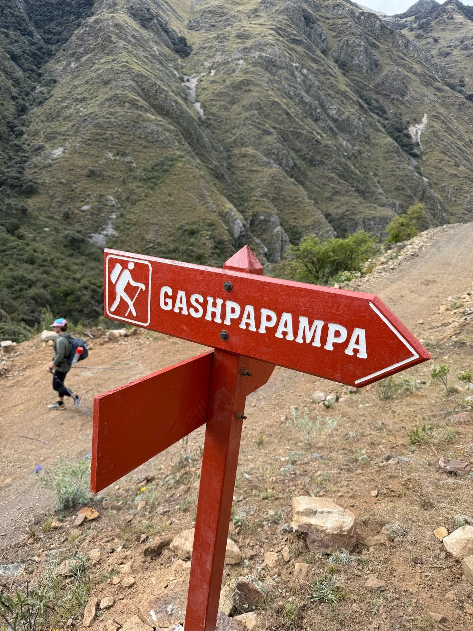
Wake up at 6:30am to darkened skies and a sense of mission and joy. It was the last morning on the trail and I lucked out with a sleeping pad last night. Promptly, the frenchman came and grabbed the pad while I was in the tent, “Thanks mate” he whispered and took off. “Good luck on your day today” I said back. We sack up the camp and take just under two hours to get things together, dry off the tent, filter water and breathe for a bit. We took a few stretches and cleaned up our gear. I notice a rip in the midfoot of my left shoe, not a big issue but slightly unnerving that the new trail runner was already wearing out, just ~100 miles into use. I rolled things back up into the fastpack and smooth our my straps with inreach, phone, and some nutrition. Our day looked like the following - rock it out of Huayllapa due north to climb to Punta Tapush just west of Mt Tapush (16,170ft). The climb would be roughly ~4,000ft for direct climbing on burro trails dredged our over years and years of muling. Along the way we’d pass by some high pass camps and make out way to the pass at our highpoint of the day. From there we’ll descend to the Campo Qashpapampa to check in and pay our fees for the community area. From here is where it may get sticky as we’ll veer off the trotten path of the Huayhuash Circuit to save some time preserve daylight to get back to Llamac by tonight.
Once past the campo, we take a line on the map following the Rio Achin to the south west of Laguna Jahuacocha and just below Pampa Llamac. Although we saw this line on the map to cut some miles off and was just a thin line. The type of thin line that meant the map was drawn this way or the trail is seldom used. As it came to be, it was just that, a trail that was seldomly used.
We bounced up the steep section out of town which felt more like an early baptism than a steady walk out of town. Not five minutes out of camp the skies begin to open up on us and it may just be that type of day. Throw on the rain jackets for the first time and we keep on cranking up, through the gate following signs for Campo Watiaq. The trail follows through a narrow gulch that seems to continue onwards and on. The skies begin to clear up a bit and we drop the jackets after about an hour. Our paces began to slow as we tread up a wet and sometimes mucky trail. I sight a man on a horse clomping along ahead of us quite a ways, looks like a fun way to pass the time on the trail. He was accompanied by a muleteer which was the same way our friend David had completed the trail earlier in the year when he was traveling through the country. Sun comes out and it begins to dry out, back to the clear views of the Huayhuash. We pass a few parties of tourist who were moving slow, clad in hooded sun shirts and big boots. We said good morning and pushed our way past with slighted breathe. We finally make it towards the top and break out for a rest and a snack. Scratch chews it is and some liquid. I started to feel a bit gassed at this point after this climb and our pace. We jumped back up and began to move with zest. The gulch gave way to a plateau and the trail steadied but climbed enough to slow our pace further. Incredible views of Mt Tapush and Diablo Mudo, shrouded in fast moving clouds and snow. Once we have the summit in view we come in on another party and it was that of the frenchmans whose secured the sleeping pad for me last night. We caught up and chatted with him and his wife - they had been traveling for the past six months before she begins a new job. I loved hearing his story and hoped to keep in touch. Our pace surpassed them and we then had the task of moving past their pack of burros up ahead. We traded pace with them for about half a mile on a steep climb until they relented and took a break to prepare for the people who were going to stop and eat a snack/lunch at some point. We were waiting for a descent into the Qashpapampa for our lunch break.
As the crowds cleared at 15,570ft we hit our high point of the day thrilled but gassed from the big push. Garrett threw in some coco leaves to help relieve the pain of the climb and ease us into a descent we were cautiously thinking about. The view from the high point was awe inspiring with a view of western peaks of the Huayhuash rising through the horizon with towering snow capped peaks and deep valley floors. At this point the sun hid behind the clouds and the clouds thickened as we walked, hoping for no rain and just some cover up above. Tights and a long sleeve went on and we kept chugging down the trail, ended up in the camp in about an hour. Once in, it was deserted except for a few campesinos roaming and one guiding outfit pitching tents. We found a bathroom with running water out in a field with three walls - we jumped in to get out of the cold breeze to put on windbreakers and eat lunch. Down went a cliff bar along with more scratch. We filtered water and readied ourselves to finish the day. We paid the fee collector and told them of our plans. On the map, the trail seemed to diverge a bit round Laguna Susococha north of the camp. The western route seemed to be the best and well trottened trail so we stuck with this versus the one we could see on the east side of the trail. The fee collectors sounded weary of our plan as we tried to rely to them we were headed to Llamc today. They ended the conversation joyed we paid them and pointing us north to the trail. Theoretically, it was mostly if not all downhill from here but I figured something may be up at some point in the trail as our gps track seemed to show a significant climb right at the end before the push into Llamac.
Past camp we followed the map and started to drop and the trail twist and turned and began to fade. We could see below us the transition from the circuit and our planned path. We scrambled down a steep grassy knoll littered with medium sized rocks that made it just enough of a pick through to be some work. Guessing on the trail, it seemed to be gone at this point and maybe we used mainly by burros and locals at this point. We continue on and find a scant trail running along the water that rushed below us in a small ravine while descending the valley floor north. We kept going and I kept an eye on the GPS to ensure we were on the track we planned for. We kept losing the trail and regaining it which added to my anxiety.
For the next hour or so we stuck to the descending river and stayed on something that began to feel more and more like a trail. At some point it begun being used more but it was unclear where that was. What was clear was that we hadn’t seen a single person or animal since we got off the circuit and its doubtful we’ll see anything the rest of the way.
Eventually we made it to a massive knoll and the valley parted to the east or west ahead fo us but not north. A massif stood in front of us inching closer and closer as we dropped the trail behind us. Our GPS showed up headed straight at this point and I relented how we could possibly be going up this mountain with no obvious trail and its sheer enormity of it. We dropped down a steep and overgrown thin trail straight down to the valley floor where a dirt road was. On the map this seemed to head due west and south on the main road between Chiquian and Llamac, about 10km due south of Llamac. This seemed like an easy route out of the Cordillera but would be boring and add a few extra miles onto the end. At this point it felt inconceivable to add any more miles onto the day so we dug deep and looked for a point to cross the river next to the road. Not like what we’ve encountered thus far, this river was raging, moving quickly and one I didn’t want to get into let along wade. We looked up and down the road and didn’t see a place to cross. Studying the GPS it was east for a few hundred feet to cross the river, alas we found an old tree log laid across with some branches. It didn’t look great but it was our only option and seemed to fit the bill. We sent it across, I went first and made it safely. Garrett went and nearly lost his shit and fell in. He caught on a side branch and kept going, noticeably this log as wet and just greasy. We were at roughly ~12,200ft at this point, dropping 3k from our highpoint back at the Punta. The sun comes out and bakes us. The mountain side feel dense with shroud and small bushes, some thorny in nature. The clearing was sandy and we attempted to filter water, regroup, gain some composure and study the gps track and we couldn’t find any obvious trail around us. It looked like we had to head straight up and due west to get out of there. I feel a few bites on my leg, then notice about 50 mosquitoes clinging to my leg and calf muscle. The stringing began to intensify and hurt, a lot. I told Garrett we needed to get out of there and I started pacing and jumping to keep them off of me, but I needed to stand still to filter my last 500ml flask of water fo the climb out. Garrett starts to get agitated with me as the days fatigue sets in and anxiety builds about just where to go at this point. I began desperately looking for a trail and push through the branches more up the mountain side to finally find something that resemble a game trail. We would of bushwhaked up the mountain to find the track but it was so steep and dense I don’t think we had the energy to make it. I yelled to Garrett to follow me as I followed along the trail gaining altitude. “This has to be it” I yelled to him as I’m watching the phone. He trudged up and the overgrowth clears to low lying shrubs and bushes with thorny ends poking out as to warn us this is not the way. My assumption is that this is a seldom used local trail. About half way up we see an obvious trail that is cut right out of the side of the cliff side as to which we want to get up onto. It’s promising having this in sight and we push onwards to the trail.
We make it and are delighted to be on something obvious again. The GPS looks good and we drink some water. That was an ordeal - the heat, mosquitoes, lack of trail, and uncertainty induced an stress response and ensuing rush of energy up until this point. It was wild to look at the track and know we were nearly on the final approach, it felt tangible the distance left and I could wrap my head around just what was left to be undertaken. The sun was still fairly high in the sky with scattered clouds surrounding, but the threat of rain was gone and the darkened clouds dissipated in the distance. Looking ahead as we walked, we saw what looked to be an Andean Mountain Cat up ahead trotting along the trail, it was special to see. At this point, Garrett and I kept a steady hiking pace and made headway on the remainder of the trail. It was unclear the purpose of this trail but it was graded to that of a railway. Steady it meandered and climbed up the cliff side. As we settled, we began talking about things of the future, hot meals, cars, modern life, and the return to Llamac.
After what felt like a few hours, we rounded an exposed corner with a clearing above it to what looked to be a small radio tower and shack on the distance. From here, we turned off and took a descending trail. The trail widened and sunk into the ground. It appeared in a rain storm the water eroded this trail over years and would be an absolute mess. We began down the trail and my adrenaline was running, was this it? At a rounded corner we saw Llamac in the distance easy down below the mountain valley. It didn’t seem real, had we really come all this way to close the loop in just 4 days? I had difficulty recalling what it felt like to walk out of Llamac that morning with energy, zest, and the unknown ahead of us. As excited as I was to complete this I equally was filled with pain, unease, and general anger. The sentiment I usually get at the conclusion of an adventure, defined as having taken a piece of me and given me something in return. The thought of returning to everyday life and everything I had left behind.
We switched back for about 45 minutes until we descended a path behind a rubble shack in someones backyard which led us into the town. It all looked and felt familiar, the return to Llamac. We walked stepped onto the paved road through the center of town and immediately were hit with the sensation of fulfillment. I highfived Garret and gave him a hug. “Holy shit we did it man, we really did.” The stoke was shared and now it was time to find Hospedaje: Nazario and our friend Oerospoma Nunez to take care of us. We found the old man in the bottom floor of the bodega with just one small light behind the counter and signaled to him we were back. He seemed surprised and bewildered for a moment before signaling to us that we could stay there again. With absolutely no english or savvy body language, he briefly spoke to us deeply in spanish and we waited for Nunez to come back to the building. We hung out and waiting until she showed up, sweaty and out of breath. I felt terrible she was summonsed for us, but otherwise we had no where to go but sit in the street. No english, no signs, no open doors in this town. We had a great chat with her without English and she was delighted to see us. She set us up on the third floor in the same room we had been in before we started the fastpack sans duffel bags. Garret looked concerned but I assured him they were somewhere and we just had to have her track them down. Once we got her attention a short while later, she showed us the bags in a room and we brought them up to our room.
Alas, we had returned safely, healthy and happy. Stoked and enlightened with all of our equipment and expedition bags in the room. There was nothing left to sit and enjoy ourselves, eat some food, and begin the journey back to Hauarz to finish our the trip. It had truly been what I was hoping for in Peru. I couldn’t have been more luck to have Garrett as my partner on this trip and to get through all the muddy moments of the 4 days.
These four days served as a fast track to an immediate and deep confrontation of who I am and how far I want to go in life.